Four Google Maps Updates To Help You Explore U.S. National Parks

Photo by Aniket Deole on Unsplash
By: Cindy Medina
A personal goal of mine this year is to visit the U.S. National Parks closest to me. I recently visited Point Reyes National Seashore in Northern California, a must-do! I like to do extensive research before I plan any type of trip. I rely heavily on Google Maps to discover new places, read reviews, and plan my routes.
Google announced last week that they added four new tools on Google Maps to help explore U.S. National Parks.
Here are the four updates:
#1 Popular Attractions
When you search a National Park you will easily be able to see the most popular attractions, campgrounds, visitor centers, and trailheads.
When you click on, say an attraction, you will be provided with additional information such as reviews, photos, and videos provided by the Google Maps Community.

Photo Courtesy of Google
#2 Popular Trails
You will be able to easily identify popular trails and see their full routes. Google use to only provide a starting location pin but now you can see the trail from beginning to end. You can do further research by reading reviews and seeing photos and videos.

Photo Courtesy of Google
#3 Detailed Directions
When you have planned out the attractions you want to see, Google Maps will give you precise directions on how to get there. Such as guiding you towards the closest park entrance. When requesting walking or biking directions to a particular trail, Google maps will direct you right to the trailhead.

Photo Courtesy of Google
#4 Maps Offline
Spotty or no cell phone coverage in national parks is common. Now you will have the option to download an offline map for a park right from the listing. The map will work when you are offline, allowing you to have a safer and well planned out route.
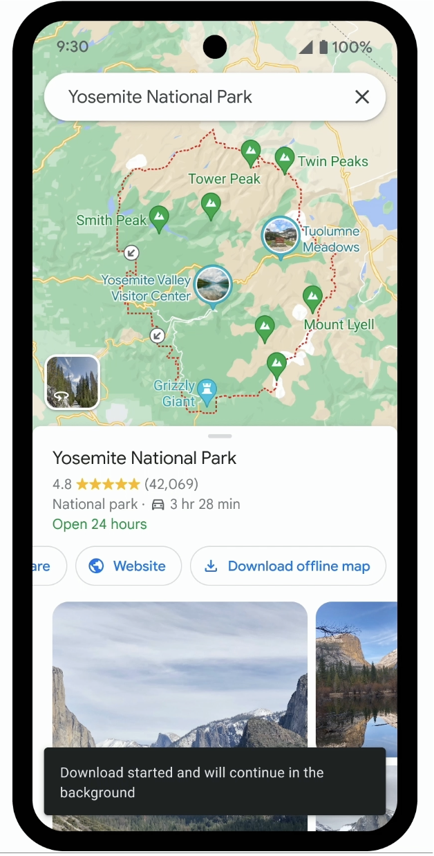
Photo Courtesy of Google
Now get out there and see the beauty of the outdoors!